At a glance
The island acropolis concentrated Tyre’s power where the city met the sea: palace and the temple of Melqart sat on a narrow, fortified ridge directly above quays, shipyards, and rows of dye vats. That intimacy of crown, cult, and commerce made Tyre a maritime polity whose prosperity and security depended on control of the sea.
What happens when the king’s rooms and the chief temple looked straight down onto the docks? In Tyre the answer was literal: a steep, narrow urban spine rose from the main quay to a palace complex and the temple of Melqart, so that ritual and political commands were issued from a position that dominated every ship coming and going. From the water the island read as a single composed signal — a fortified summit flanked by harbor works — not a dispersed town.
Physically the island was compact. Stone quays ran along sheltered basins; low warehouses and emporia hugged the waterfront. Slipways cut into these basins where shipwrights dragged hulls out of the water. Timber yards and long ropewalks occupied strips of shore next to the anchorage. Behind them, small yards of shallow stone vats steamed with the slow, greasy work of murex boiling. The crushed shells were piled in middens whose whitened slopes rose like bleached terraces visible to approaching captains.
The acropolis’s fortification lines tightened this geometry. Thick sea‑facing walls and towers ringed the island so that defenders could concentrate manpower on a small perimeter. That defensive advantage went hand in hand with dependence on maritime supply: when the sea lanes were open, provisions, timber, and trade flowed easily; when a hostile power barred the harbors, the island’s compactness became a liability. Compare Corinth or Rhodes: those cities shared Tyre’s investment in ships and specialized crafts, but Tyre’s palace and temple sat unusually close to the points of loading and departure, making religious sanction and royal privilege part of everyday commercial practice.
Three questions this place forces you to ask: how did religious authority and royal power use a single fortified ridge to regulate an international trade network; how did the concentration of purple vats, glass and textile workshops, and shipyards in a confined island space structure labor and movement; and how could a geography that made the island nearly impregnable from land also make it fatally dependent on control of surrounding waters? Answering those queries with the island’s physical facts changes Tyre from an abstract mercantile power into a city whose civic grammar was written in stone, rope, steam, and salt spray.
Closer looks
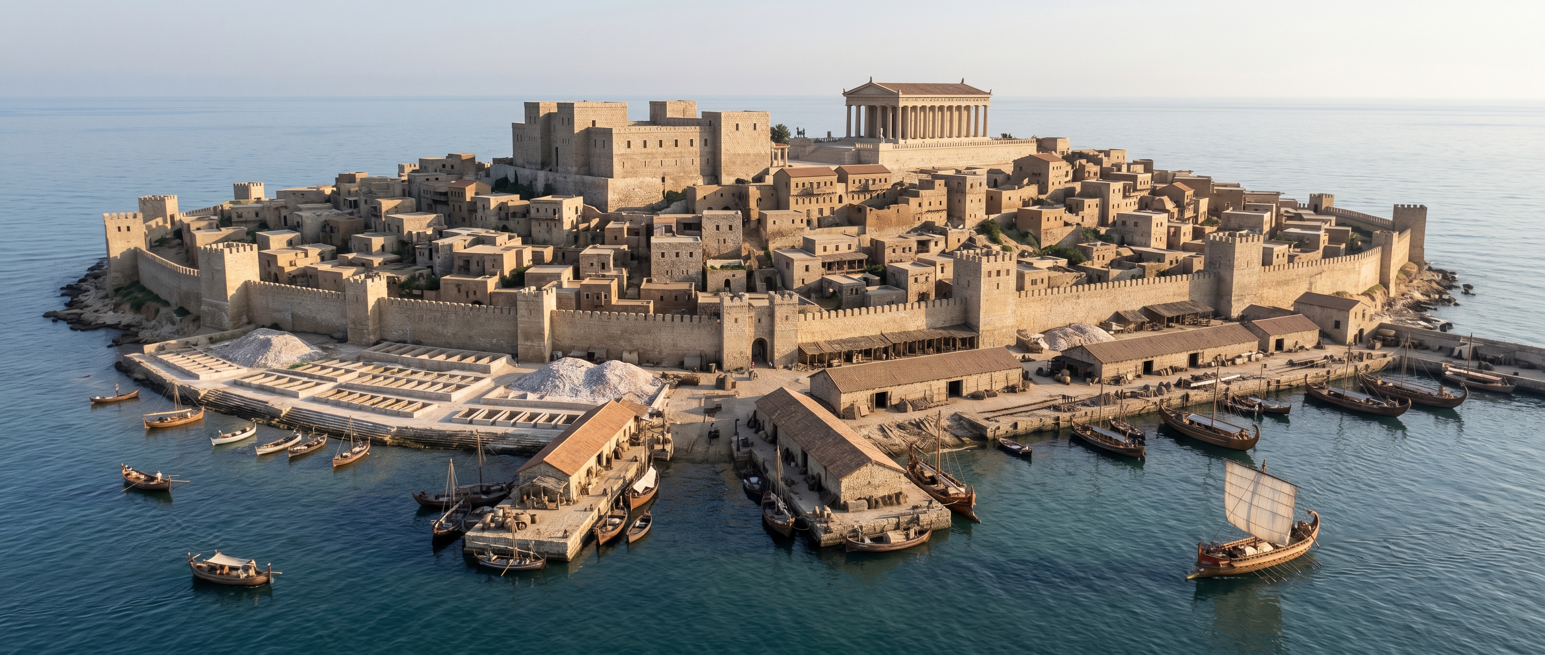
Island silhouette from an approaching ship
From the approach the island read like a deliberate message: a low stone ring topped by two blocky masses that announced palace and temple. The sea‑facing curtain wall and its regularly spaced towers created a hard horizon; above it a narrow ridge rose so that the palace’s flat bulk and the temple of Melqart’s taller platform were visible at once.
Along the waterfront the composition tightened into function. Continuous quays and low warehouses hugged sheltered basins, while rows of rectangular dye vats and their bleached shell middens formed pale terraces near the waterline. Captains thus saw not only where to land but who would claim authority over what came ashore. Before Alexander closed the gap to the mainland, that skyline broadcast both power and vulnerability: the island was easy to defend from land because it was compact, but it could be neutralized by closing the sea lanes that supplied it.
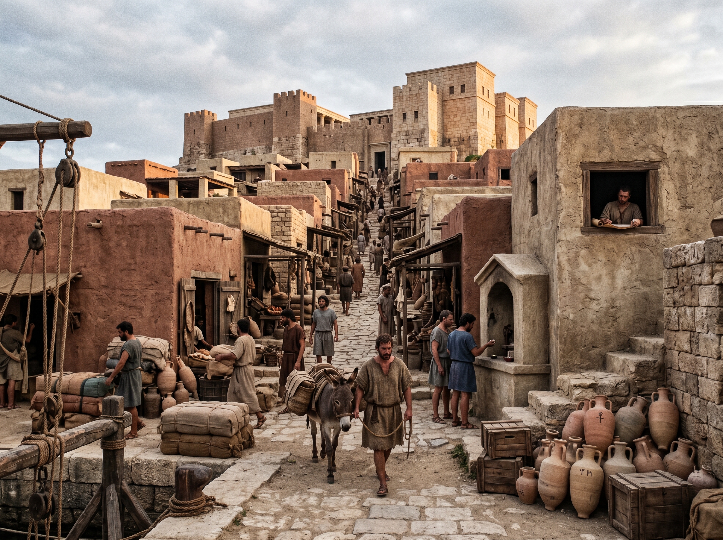
The narrow urban spine from main quay up to palace
Arrival funneled bodies and paperwork up a single, steep spine so that commercial action, administration, and ritual met in quick succession. A paved ramp rose directly from the main quay, flanked by narrow emporia and low warehouses whose open fronts let clerks inspect incoming amphorae and textiles without stepping off the route.
Sailors disembarked into a choreography of labor: pack animals and carts waited below while rope and pulley fixtures hauled boxed goods past merchants’ booths. Midway up a small shrine provided a moment to vow safe passage, and a windowed archive allowed an official or scribe to tally cargo and write receipts in full view of the quay. That visibility shortened the path between contract and enforcement; irregularities were harder to hide when the palace looked down on every crate and signature.
The short climb let magistrates check cargoes quickly and issue permits before ships left, reducing opportunities for fraud.
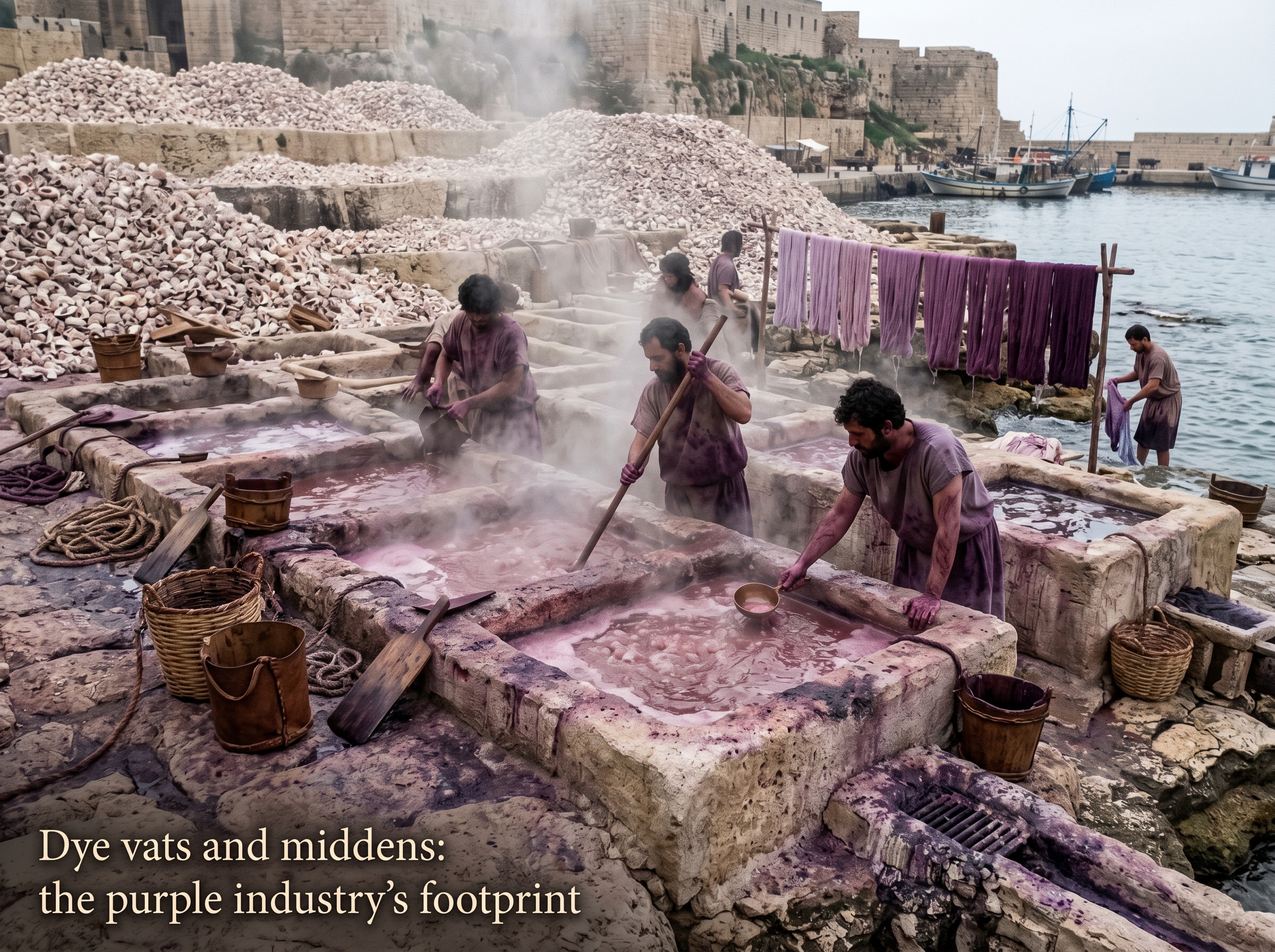
Dye vats and middens: the purple industry's footprint
The vat fields made purple production tangible: long rows of shallow stone basins, steaming and stained, with workers knee‑deep in a slow, greasy process. People boiled crushed murex, skimmed foamy residues, and moved paste into tanning and rinsing racks; staining showed on stone and skin in unmistakable purples and rusts.
Shell piles rose in terraces behind the vats. A single rich cloak could have required tens of thousands of murex shells, so the middens accumulated quickly and altered the island’s profile as much as its smell altered the air. Drains choked with ochre runoff, wooden scrapers lay near buckets, and cloths hung on simple racks to dry; the whole operation occupied a narrow strip of shore so close to the quays that finished fabrics could be loaded onto ships within hours.
Because of the scale, middens became a permanent feature of the shoreline and an archaeological marker of Phoenician dyeing activity.
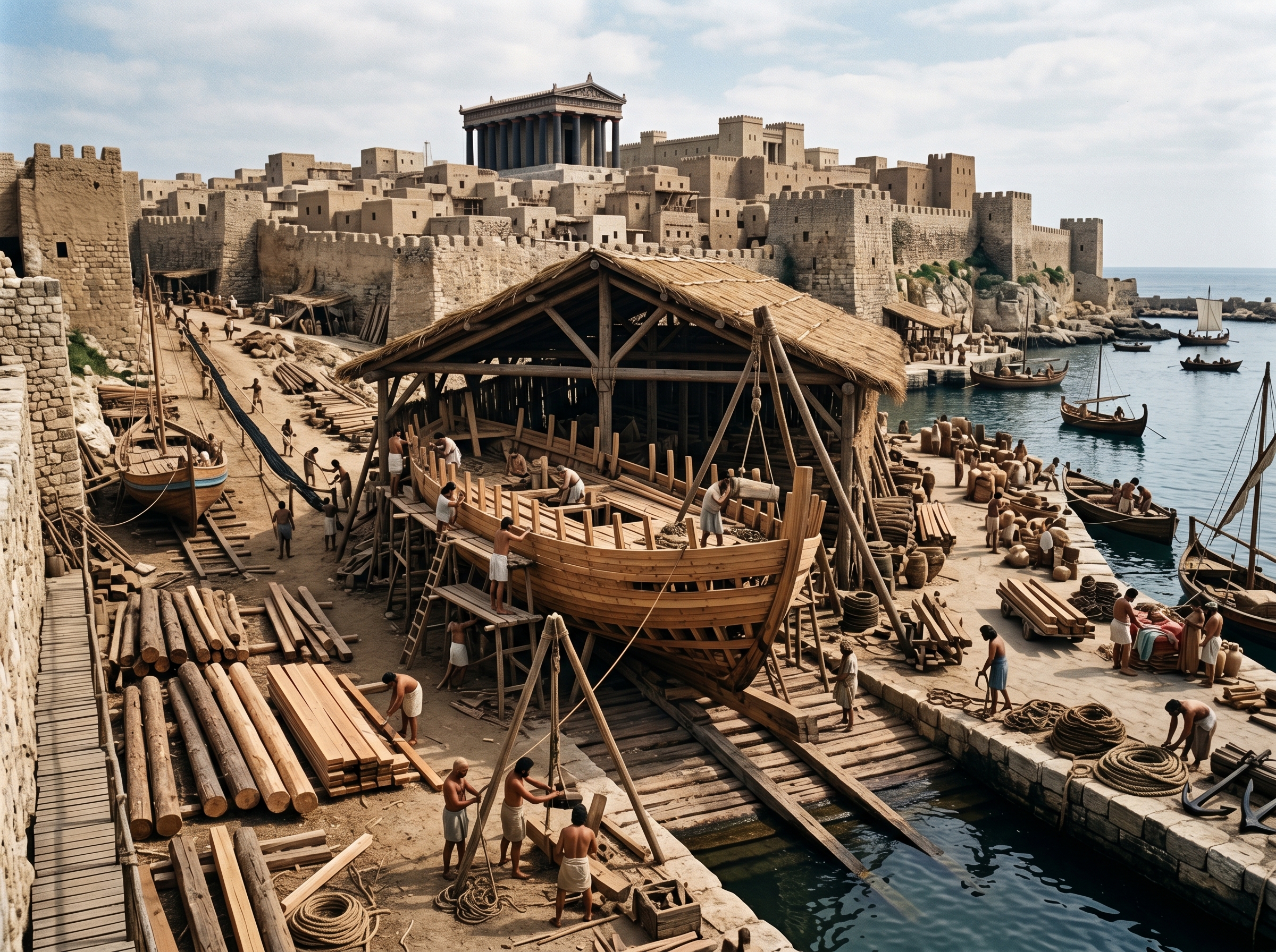
Shipwrights at work on sheltered slipways
Shipbuilding in Tyre happened where water and wood met in tight, managed spaces: sheltered basins cut into the shore with slipways for hauling hulls out of the sea. Planked ramps held partially completed hulls while teams drove mallets, fitted frames, and caulked seams with pitch and fibrous stuffing.
Behind the slipways, timber yards kept trimmed beams and stacked planks; a ropewalk ran parallel to the quay where workers turned hemp into rigging. Simple tripods and block‑and‑tackle rigs lifted heavy timbers and a few spare merchant hulls waited for launch or repair, which shows that the yards kept both local transport and long‑distance traders on the move. Timber arrivals set the work rhythm: shipwrights paced construction to when large beams reached the harbor.
The proximity of timber stacks, ropewalks, and launch spaces made it efficient to convert raw wood into seaworthy hulls in a single, crowded strip.
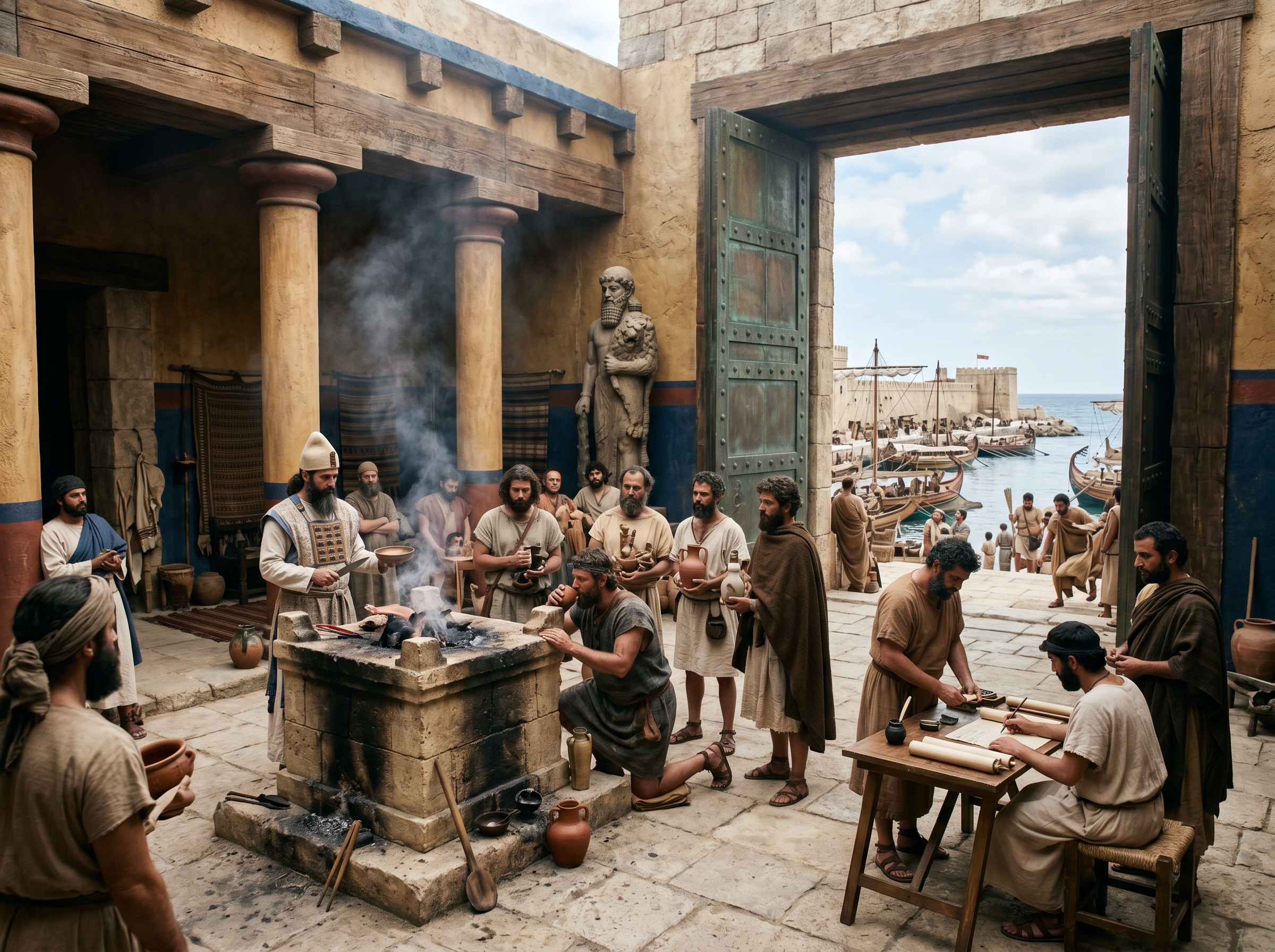
Courtyard of the temple of Melqart during embarkation rites
The temple forecourt turned departure into a public, legally resonant act: sailors swore oaths, poured libations, and bound themselves and their cargoes before the statue of Melqart. A raised altar and priests in distinctive garb turned routine paperwork into ritual obligation.
Scribes often sat nearby to record names, voyages, and promised offerings; those entries could function like a contract enforced by the city’s sacred authority. Merchants placed votive objects or pledged a fraction of cargo as a vow for safe return, so the temple was both a spiritual guarantor and a node in the city’s commercial infrastructure. Looking through the temple gate you could see moored ships—ritual and logistics literally aligned on the same axis.
Oaths before Melqart doubled as public records: priests’ lists could be consulted if disputes over cargo or crew arose.
City context
The island acropolis organized daily life in Tyre. Sailors and merchants landed at the main quay beneath the palace; goods moved from ship to warehouse to temple archive along a tight, uphill route. Before long voyages crews visited the temple of Melqart to swear oaths; magistrates and priests issued privileges and recorded transactions within sight of moored hulls. For ordinary residents this meant that ritual, administration, and commerce were not separate spheres but successive stations on the same short climb.
Work rhythms also radiated from the shore. Shipwrights set timetables by tides and seasonal timber arrivals; ropewalks stretched out along the quays to turn hemp into rigging; dye-workers boiled vats in a routine that smelled sharply of brine and fish oils and left middens that altered the island’s profile. In wartime the acropolis became the city’s nerve center: defenders manned the wall-walks and signaled to ships, while the island’s compact fortifications allowed concentrated resistance so long as resupply by sea held. Lose the sea lane, and the acropolis’s advantages flipped into constraints.
Sources
Interpretive synthesis
- City essay: interpretive synthesis on Tyre’s urban form and maritime economy (provided corpus).
Primary historical accounts
- Arrian, Anabasis Alexandri and Diodorus Siculus, Bibliotheca historica — classical accounts of Alexander’s siege and the construction of the causeway
Secondary scholarship summary
- Studies on Phoenician production and maritime commerce: descriptions of murex-based purple dye and its labor intensity (background scholarship summarized in city essay).